
Garmin Marine Charts - BlueChart g3 and Navionics+
ActiveGPS stocks two families of Garmin marine chart - BlueChart g3 and g3 Vision, and Navionics+ and Navionics Vision+. Both chart families are genuine Garmin products and both work with many Garmin chartplotters. BlueChart g3 is also compatible with a range of Garmin handheld GPS devices, whereas Navionics+ and Navionics Vision+ are designed for compatible chartplotters only. The difference is in their data source and feature set.
BlueChart g3 charts are compiled by Garmin using hydrographic and navigational data from multiple sources. Navionics+ and Navionics Vision+ charts are produced by the Navionics division of Garmin and are widely used across European waters. Both chart families are available in Regular and Large coverage sizes.
Garmin BlueChart g3 and g3 Vision Marine Charts
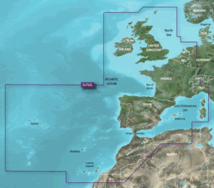
Garmin BlueChart g3 is the established chart range for Garmin chartplotters and handheld GPS devices, covering UK, European and North American coastal and inland waterways. BlueChart g3 Vision titles add Auto Guidance, which calculates a suggested route based on your vessel's draught, avoiding hazards and shallow water.
Garmin Navionics+ and Navionics Vision+ Marine Charts
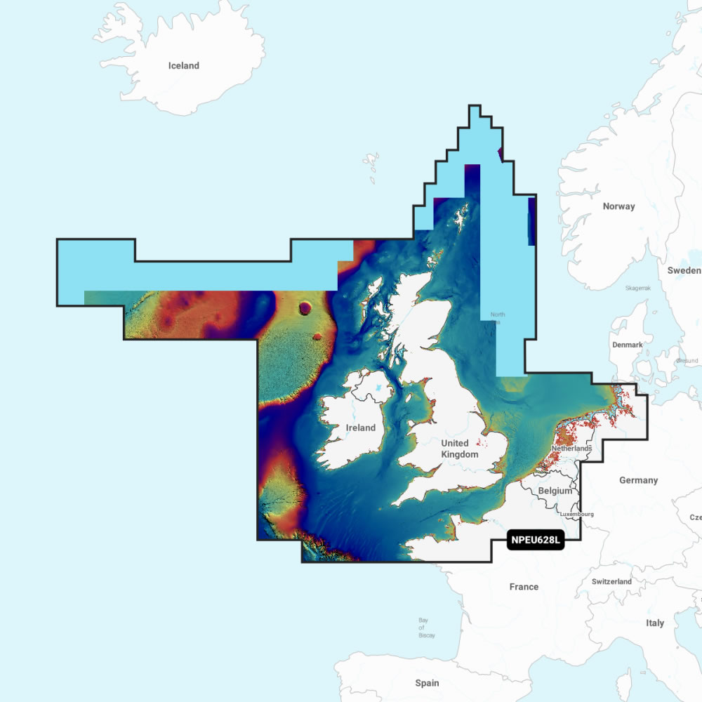
Garmin Navionics+ and Navionics Vision+ are chart cards produced by Navionics, a division of Garmin, and are widely used across European coastal and inland waters. A 1-year subscription for daily chart updates via the ActiveCaptain app is included with every Navionics+ and Navionics Vision+ purchase.
‣ Garmin Navionics+ and Navionics Vision+ Europe (Regular and Large)
 Deliveries
We offer UK, Europe and Worldwide deliveries. We despatch orders at 4:30pm on Monday, Tuesday, Wednesday, Thursday and Friday. We need to receive your order on those days by 3:00pm. When possible we may despatch orders received after that time. No orders are despatched on Saturday, Sunday or Bank Holidays in England and Wales.
We offer FREE UK delivery on all orders of £50.00 or more, plus next working day and guaranteed Saturday delivery options. Click here for further info. All options also appear at the basket pages.
Garmin Marine Charts Buying Guide
Garmin Marine Chart Comparison
| Feature | BlueChart g3 | BlueChart g3 Vision | Navionics+ | Navionics Vision+ |
|---|---|---|---|---|
| Handheld GPS compatible | Yes | Yes | No | No |
| Chartplotter compatible | Yes | Yes | Yes | Yes |
| Auto Guidance | No | Yes | Yes | Yes |
| Daily chart updates | No | No | Yes (1 year) | Yes (1 year) |
| Satellite imagery | No | Yes | No | Yes |
| 3D views | No | Yes | No | Yes |
Quick Recommendations
I have a Garmin handheld GPS (GPSMAP 64, 65, 66, 79s, 86i, Oregon or Montana series)
Choose BlueChart g3 Regular - the only chart family compatible with Garmin handheld GPS devices.
I have an older Garmin chartplotter (GPSMAP 720, 750, 820, 942, 942 Plus or 942xs)
Choose BlueChart g3 - Navionics requires a more modern chartplotter.
I have a modern Garmin chartplotter (ECHOMAP UHD, ECHOMAP Ultra, GPSMAP 722 Plus and newer)
Choose Navionics+, Navionics+ Vision for daily chart updates, or BlueChart g3 Vision for Auto Guidance without a subscription. Both work with your device.
BlueChart g3 or Navionics+ - Which Chart Should I Choose?
The first question is not which chart family you prefer - it is which charts are compatible with your device.
If you have a Garmin handheld GPS (such as the GPSMAP 64, 65, or 66 series, GPSMAP 79s, GPSMAP 86i, Oregon 700 or 750 series, or Montana 700 or 750 series), you need BlueChart g3 Regular. Navionics+ and Navionics Vision+ are not compatible with handheld GPS devices.
If you have an older Garmin chartplotter (such as the GPSMAP 550, 720, 750, 820, 942, 942 Plus or 942xs), you need BlueChart g3. Navionics+ requires a more modern unit from the ECHOMAP UHD generation or GPSMAP 722 Plus and newer.
If you have a modern Garmin chartplotter (ECHOMAP UHD, ECHOMAP UHD2, ECHOMAP Ultra, GPSMAP 722 Plus and newer), you can choose from all four options: BlueChart g3, BlueChart g3 Vision, Navionics+ or Navionics Vision+. In this case the choice comes down to data preference. BlueChart g3 Vision and Navionics Vision+ are the premium tiers and both add Auto Guidance, satellite imagery and 3D views. For most UK and European sailors, either works well.
If you are unsure which chart is compatible with your specific Garmin model, call us on 01733 777623 (Monday to Friday, 9:30am to 5:00pm) and we will confirm before you order.
What is the Difference Between g3 and g3 Vision?
BlueChart g3 is the standard tier and includes detailed coastal charts, depth contours, tides and port information for UK, European and North American waters. BlueChart g3 Vision adds Auto Guidance route planning with compatible Garmin chartplotters (calculates a suggested path based on the vessel's draught, avoiding hazards and shallow water). g3 Vision titles also include high-resolution satellite imagery, 3D perspective views, and aerial photos of ports and marinas. Auto Guidance requires a compatible Garmin chartplotter and is not available on handheld GPS devices.
What is the Difference Between Navionics+ and Navionics Vision+?
Both Navionics+ and Navionics Vision+ include coastal content, 5m depth contours, Auto Guidance+ route planning technology, and a 1-year subscription for daily chart updates via the ActiveCaptain app. Navionics Vision+ adds relief shading, high-resolution satellite imagery, aerial photos of ports and marinas, 3D FishEye view, and 3D MarinerEye view. Navionics Vision+ is broadly equivalent in feature set to BlueChart g3 Vision.
Regular vs Large Coverage - Which Size Do I Need?
Both BlueChart and Navionics charts are sold in coverage sizes, including Small, Regular and Large. A Regular chart covers a defined coastal region such as the English Channel or the Irish Sea. A Large chart covers a broader area such as all UK and Ireland waters. If you regularly cruise between regions, a Large chart avoids needing to swap cards mid-trip. Check coverage maps on the individual chart pages before purchasing - if you are unsure which title covers your waters, call us on 01733 777623 and we will advise.
Are These Charts Compatible with My Garmin Device?
Garmin BlueChart g3 and Navionics+ charts are compatible with a wide range of Garmin chartplotters and marine handheld GPS devices, including the echoMAP, GPSMAP, and STRIKER series (where applicable). Charts are supplied on a microSD card and inserted into the compatible slot on your device. If you are unsure whether a chart is compatible with your specific model, call us on 01733 777623 (Monday to Friday, 9:30am to 5:00pm) and we will confirm before you order.
Garmin Marine Chart Compatibility
Garmin marine charts are supplied on microSD card and inserted into the compatible card slot on your device. Not all chart families are compatible with all Garmin devices, so it is important to check before purchasing. If your Garmin device shipped with BlueChart g2 as standard, g2 titles are still available from ActiveGPS - call us on 01733 777623 to confirm the right title for your model.
Garmin handheld GPS devices (including the GPSMAP 64, 65, 66 series, GPSMAP 79s, GPSMAP 86i, Oregon 700 and 750 series, and Montana 700 and 750 series) are compatible with BlueChart g3 only. Navionics+ and Navionics Vision+ do not support handheld GPS devices.
Older Garmin chartplotters (such as the GPSMAP 720, 750, 820, 942, 942 Plus and 942xs) are compatible with BlueChart g3 only. Navionics+ requires a more recent chartplotter from the ECHOMAP UHD generation or GPSMAP 722 Plus and newer.
Modern Garmin chartplotters (including the ECHOMAP UHD, ECHOMAP UHD2, ECHOMAP Ultra, GPSMAP 722 Plus, GPSMAP 922 Plus, GPSMAP 923, GPSMAP 1022, GPSMAP 1222 and the GPSMAP 8400 and 8600 MFD series) are compatible with all four chart options: BlueChart g3, BlueChart g3 Vision, Navionics+ and Navionics Vision+. The GPSMAP 8400 and 8600 MFD series additionally ship with built-in BlueChart g3 coastal cartography and LakeVu g3 inland mapping (which incorporates Navionics data) preloaded as standard.
If you are unsure whether a chart is compatible with your specific Garmin model, call us on 01733 777623 (Monday to Friday, 9:30am to 5:00pm) and we will confirm before you order.
Garmin Marine Charts Questions and Answers
Question: What is the difference between Garmin BlueChart and Navionics charts?
Answer: Both BlueChart g3 and Navionics+ are genuine Garmin products. BlueChart g3 is compatible with many Garmin chartplotters and Garmin handheld GPS devices, whereas Navionics+ is designed for compatible Garmin chartplotters only. The key difference is in the data source and update model. BlueChart g3 charts are compiled by Garmin using hydrographic and navigational data from multiple sources and are particularly strong for North American coverage. Navionics+ is produced by the Navionics division of Garmin, uses Navionics data with 5m depth contours, and includes a 1-year subscription for daily chart updates. For most UK and European boaters, either chart family works well.
Question: Do I need BlueChart g3 or g3 Vision for Auto Guidance?
Answer: You need BlueChart g3 Vision for Auto Guidance. The standard BlueChart g3 tier does not include this feature. BlueChart g3 Vision adds Auto Guidance route planning, which calculates a path through coastal waters based on your vessel's draught, automatically avoiding shallow water and hazards. Auto Guidance also requires a compatible Garmin chartplotter - it is not available on handheld GPS units.
Question: How do daily chart updates work with Navionics+?
Answer: Every Navionics+ and Navionics Vision+ purchase includes a 1-year subscription for daily chart updates delivered via the Garmin ActiveCaptain companion app. During the subscription period, your chart card receives updated depth soundings, marina information, and hazard data contributed by the Navionics boating community. You connect your compatible Garmin device to the ActiveCaptain app to download the latest available data. After the 1-year subscription expires, the chart card continues to function with the last downloaded data.
Question: Can I use the same chart card on more than one Garmin device?
Answer: Garmin BlueChart and Navionics chart cards are designed for use on a single device at a time. A chart card can only be used in one compatible device at a time. If you want charts available simultaneously on multiple devices, you will generally need a separate chart card for each. The card is inserted into the microSD slot of the device you are using it with. If you are unsure how many cards you need for your setup, call us on 01733 777623 and we will advise before you order.
Question: How do I know which chart covers my sailing area?
Answer: Coverage maps for every BlueChart and Navionics chart title are shown on the individual product pages on ActiveGPS.co.uk. Both chart families are available in Regular and Large coverage sizes. A Regular chart covers a defined coastal region such as the English Channel or the Irish Sea. A Large chart covers a broader area such as all UK and Ireland waters. If you regularly cruise between regions, a Large chart avoids the need to swap cards mid-trip. If you are unsure which title covers your home waters, call us on 01733 777623 (Monday to Friday, 9:30am to 5:00pm) and we will help you find the right chart.
 Why Buy from ActiveGPS?
ActiveGPS.co.uk is an official Garmin Authorised Internet Retailer. We sell genuine Garmin products, accessories, and maps purchased directly from assigned Garmin UK distributors. We do not source from the grey market and we do not sell counterfeit products. Purchasing from ActiveGPS.co.uk means you receive the full support of Garmin UK and a valid manufacturer's warranty on every product.
We have been selling Garmin marine charts for many years and our team can advise on the right chart family, coverage area, and title for your vessel and waters. Call us on 01733 777623 (Monday to Friday, 9:30am to 5:00pm) or contact us online.
This page was last updated on: 9th August 2026