
Menu
Marine
FREE UK delivery when you spend £50 - see more delivery options.
Home / Marine / Garmin Marine Charts / Garmin Navionics Marine Charts / Garmin Navionics Europe Regular / Garmin Navionics UK and Ireland Lakes and Rivers Inland
Product Codes: NSEU072R and NVEU072R

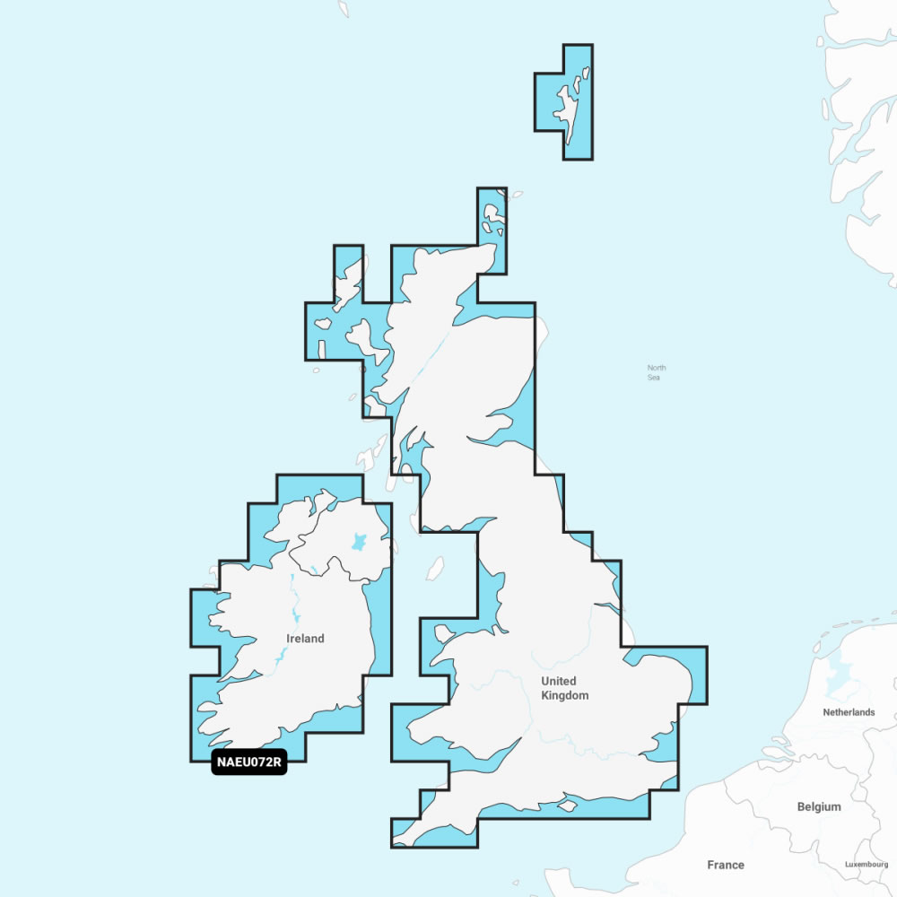

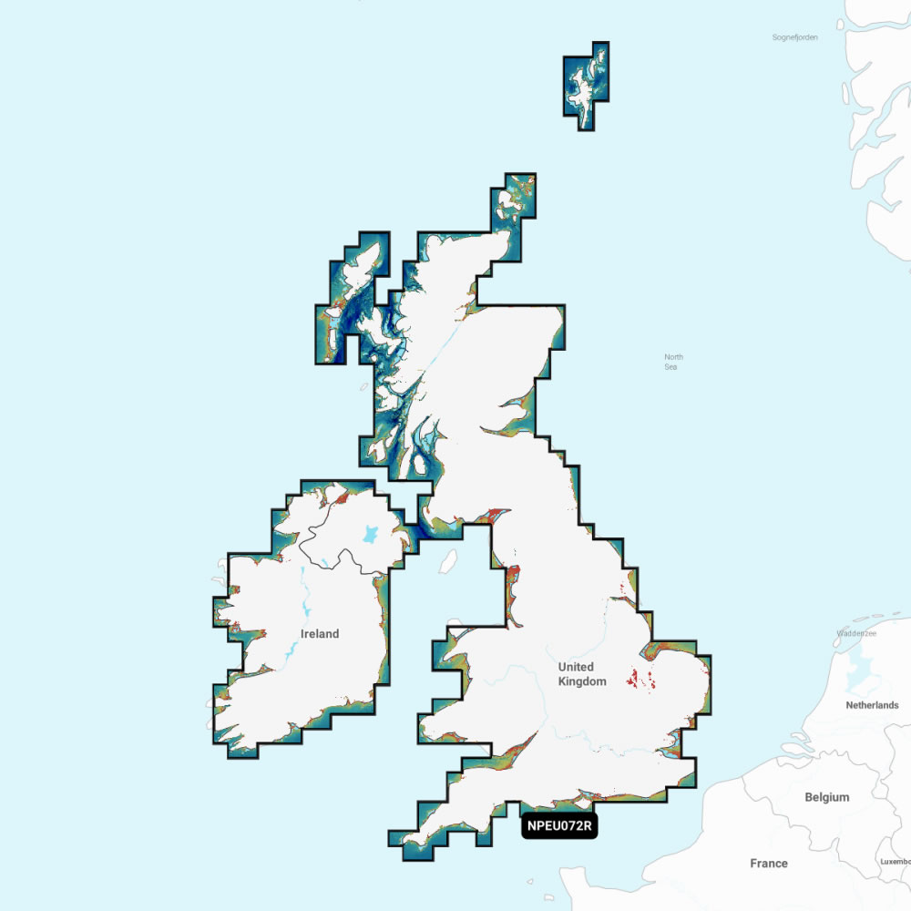

Garmin Navionics+ UK and Ireland, Lakes and Rivers inland marine charts provides rich, seamless marine charting for your compatible Garmin chartplotter using integrated Garmin and Navionics marine cartography data. This marine chart is also available as a Navionics Vision+ version which has additional features including aerial photography of ports and harbours, 3D MarinerEye view and more (read more below).
Detailed coverage of major lakes and rivers of the UK and Ireland. Coverage includes the Thames, Medway, Mersey, Avon and Tweed Rivers in the UK and the Shannon River in Ireland. Lake coverage includes Lock Ness, Loch Lochy and Lough Neagh in the UK.
Supplied on pre-programmed SD card simply insert the plug-and-play SD/microSD Card into your compatible Garmin chartplotter, select the marine chart via your Garmin chartplotters on-screen menu and you are ready to use.
Choosing the right Garmin marine chart? Garmin Navionics+ and Navionics Vision+ are designed for compatible modern Garmin chartplotters and include a one-year chart update subscription. If your chartplotter isn't listed as compatible, or you have a Garmin marine handheld, choose Garmin BlueChart, a one-off purchase with no subscription required. Not sure which marine chart is right for your Garmin? See our full BlueChart vs Navionics comparison.
Compatibility: Please see 'What is the chart compatible with?' for full list of compatible Garmin chartplotters that the Garmin Navionics+ and Navionics Vision+ Scotland, West Coast Marine Chart microSD/SD card will work with.

Garmin Navionics+ UK and Ireland, Lakes and Rivers Inland Marine Charts microSD/SD card - £149.99
Garmin Navionics Vision+ UK and Ireland, Lakes and Rivers Inland Marine Charts microSD/SD card - £239.99
 Navionics Deliveries ONLY
We offer UK, Europe and Worldwide deliveries. Garmin BlueChart orders are despatched at 3.00pm on Monday, Tuesday, Wednesday, Thursday and Friday. We need to receive your BlueChart order on those days by 12:00pm. When possible we may despatch orders received after that time. No BlueChart orders are despatched after 3.00pm and no orders are despatched on Saturday or Sunday.
We offer FREE UK delivery on all orders of £50.00 or more, plus next working day delivery options. View all delivery options. Delivery options also appear at the basket pages.
 Available above to purchase on this webpage you have a choice of Garmin Navionics+ and Navionics Vision+ marine charts. Both versions provide the same marine chart coverage of the inland rivers and lakes in United Kingdom (England, Scotland, Wales and Northern Ireland) and Republic of Ireland. What is the difference? Garmin Navionics Vision+ version includes additional features such as: high-resolution satellite imagery, aerial photography of ports, harbours, marinas and waterways and 3D FishEye view and 3D MarinerEye view. These premium features are not found on the standard Navionics+ marine charts.
Both versions of the Garmin Navionics+ and Navionics Vision+ marine charts are supplied on pre-programmed microSD card within an SD adaptor. Once inserted into the SD card slot on your compatible Garmin chartplotter they provide you with detailed-rich marine charts. Some of the features shared on both versions of the Garmin Navionics+ and Navionics Vision+ marine chart include:
Daily Chart Updates - Buy with confidence from ActiveGPS.co.uk with a FREE 1 year subscription with your Garmin Navionics+ or Navionics Vision+ marine chart. Garmin marine charts are constantly being enhanced with new and amended content. Garmin confirm that as many as 5,000 updates are made every day. The 1 year included subscription gives you access to daily chart updates via the ActiveCaptain smart device App.
Your purchase includes a one-year Garmin Navionics subscription. Charts and content downloaded during that year remain on the card permanently. After the year ends, your existing charts continue to work, but new daily updates and premium features require a subscription renewal, managed through the ActiveCaptain app.
Auto Guidance+ technology - combining the best of Garmin and Navionics automatic routing features, built-in Auto Guidance+ technology gives you a suggested dock-to-dock path to follow through channels, inlets, marina entrances and more. Please note: Auto Guidance+ is for planning purposes only and does not replace safe navigation operations.
 ADepth range shading - high-resolution depth range shading lets you select up to 10 colour-shaded options and view your designated target depths at a glance.
Up to 0.5 M contours - for improved fishing and navigation, up to 0.5 m contours provide a clear depiction of bottom structure for improved fishing charts and enhanced detail in swamps, canals, harbours, marinas and more.
Shallow water shading - to give a clear picture of shallow waters to avoid, this feature allows for shading at a user-defined depth.
ActiveCaptain community - community-sourced content provides useful POIs, such as marinas, anchorages, hazards, businesses and more. Get recommendations from boaters with firsthand experience of the local environment.
Because all of our Garmin Navionics marine charts are made to order (custom made at time of purchase) they cannot be cancelled once ordered nor returned for refund. Therefore, please ensure that you are definitely ordering the correct chart and that you have checked that is compatible with your Garmin chartplotter. We cannot accept any cancellation (even if we have not yet despatched it) nor can we accept the return of a Garmin Navionics order as all charts are 'made-to-order'. Please make sure the microSD/SD card you are purchasing is compatible with your Garmin chartplotter prior to placing your Garmin Navionics cartography order.
Detailed coverage of major lakes and rivers of the UK and Ireland. Coverage includes the Thames, Medway, Mersey, Avon and Tweed Rivers in the UK and the Shannon River in Ireland. Lake coverage includes Lock Ness, Loch Lochy and Lough Neagh in the UK.
‣Coastal content
‣Detailed nautical charts
‣0.5m contours
‣Daily marine chart updates for 1 year
‣Auto Guidance+ technology
‣ActiveCaptain App support
‣ActiveCaptain community
‣Seabed Areas
‣Depth range shading
‣Shallow water shading
‣Genuine Garmin map product
‣Relief shaing*
‣High-resolution satellite imagery*
‣Aerial photos - ports, harbours, marinas, waterways and coastal roads
‣3D FishEye view
‣3D MarinerEye view
*subscription feature
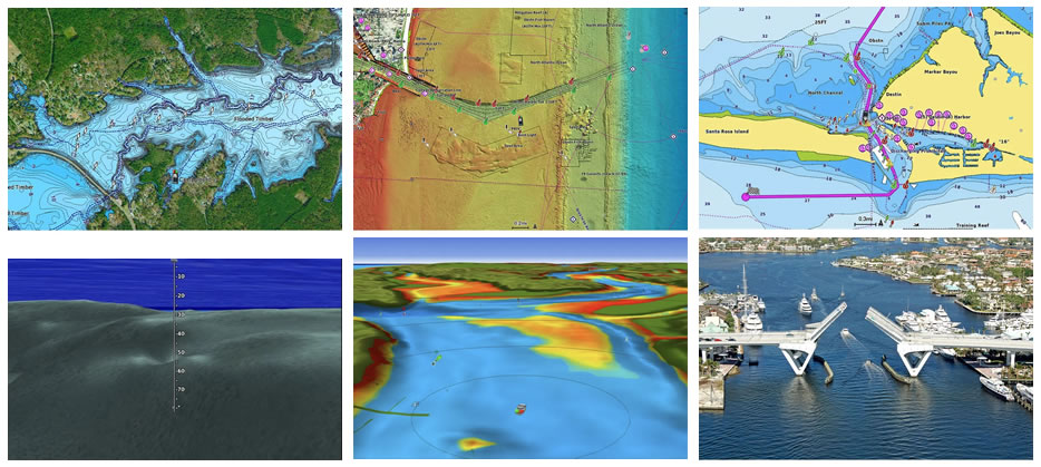
Please note: The images above are screenshots from various Garmin Navionics+ and Navionics Vision+ charts and NOT necessarily from the marine chart available to buy from this page.
Which Garmin marine chart do I need? Garmin Navionics+ and Navionics Vision+ are designed for compatible Garmin chartplotters and include a one-year subscription for daily chart updates via the ActiveCaptain app.
They are not compatible with all Garmin chartplotters, and are not compatible with any Garmin marine handheld GPS. If your chartplotter isn't listed as compatible below, or if you have a Garmin marine handheld, you'll need a Garmin BlueChart map instead. BlueChart is a one-off purchase, available in matching coverage areas, with no subscription required. See our full BlueChart vs Navionics comparison, or check your exact model against our compatibility list below.
The Garmin Navionics+ UK and Ireland, Lakes and Rivers Inland Marine Charts on SD card (Product Code: NSEU072R) is ONLY compatible with the following Garmin chartplotters:
Garmin ECHOMAP UHD 72cv, ECHOMAP UHD 72sv, ECHOMAP UHD 73cv, ECHOMAP UHD 73sv, ECHOMAP UHD 74cv, ECHOMAP UHD 74sv, ECHOMAP UHD 75cv, ECHOMAP UHD 75sv, ECHOMAP UHD 92sv, ECHOMAP UHD 93sv, ECHOMAP UHD 94sv, ECHOMAP UHD 95sv, ECHOMAP UHD2 5" Chartplotter, ECHOMAP UHD2 5" cv Chartplotters, ECHOMAP UHD2 6" Chartplotters, ECHOMAP UHD2 6" sv Chartplotters, ECHOMAP UHD2 7" Chartplotter, ECHOMAP UHD2 7" cv Chartplotters, ECHOMAP UHD2 7" sv Chartplotters, ECHOMAP UHD2 9" Chartplotters, ECHOMAP UHD2 9" sv Chartplotters, ECHOMAP Ultra 102sv, ECHOMAP Ultra 106sv, ECHOMAP Ultra 122sv, ECHOMAP Ultra 126sv, ECHOMAP Ultra 2 10" Chartplotters, ECHOMAP Ultra 2 12" Chartplotters, ECHOMAP Ultra 2 16" Chartplotters, GPSMAP 722 Plus, GPSMAP 722xs Plus, GPSMAP 723/723xsv, GPSMAP 742 Plus, GPSMAP 742xs Plus, GPSMAP 743/743xsv, GPSMAP 922/922xs Plus, GPSMAP 923/923xsv, GPSMAP 943/943xsv, GPSMAP 1022/1022xsv, GPSMAP 1042xsv, GPSMAP 1222/1222 Plus/1222 Touch, GPSMAP 1222xsv/1222xsv Plus/1222xsv Touch, GPSMAP 1223/1223xsv, GPSMAP 1242 Plus/1242 Touch, GPSMAP 1242xsv/1242xsv Plus/1242xsv Touch, GPSMAP 1243/1243xsv, GPSMAP 1523xsv, GPSMAP 1543xsv, GPSMAP 1623/1623xsv, GPSMAP 1643/1643xsv, GPSMAP 8410/8410xsv, GPSMAP 8412/8412xsv, GPSMAP 8416/8416xsv, GPSMAP 8417 MFD, GPSMAP 8422 MFD, GPSMAP 8424 MFD, GPSMAP 8610/8610xsv, GPSMAP 8612/8612xsv, GPSMAP 8616/8616xsv, GPSMAP 8617 MFD, GPSMAP 8622 MFD, GPSMAP 8624 MFD, GPSMAP 8700 Black Box, GPSMAP 9010/9010xsv, GPSMAP 9013/9013xsv, GPSMAP 9017/9017xsv, GPSMAP 9019, GPSMAP 9022, GPSMAP 9024, GPSMAP 9027, GPSMAP 9210/9210xsv, GPSMAP 9213/9213xsv, GPSMAP 9217/9217xsv, GPSMAP 9219, GPSMAP 9222, GPSMAP 9224, GPSMAP 9227, GPSMAP 9500 Black Box, Panoptix PS22-IF Ice Fishing Bundle, Volvo Penta Glass Cockpit System.
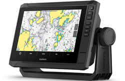
The Garmin Navionics Vision+ UK and Ireland, Lakes and Rivers Inland Marine Charts on SD card (Product Code: NVEU072R) is ONLY compatible with the following Garmin chartplotters:
Garmin ECHOMAP UHD 72cv, ECHOMAP UHD 72sv, ECHOMAP UHD 73cv, ECHOMAP UHD 73sv, ECHOMAP UHD 74cv, ECHOMAP UHD 74sv, ECHOMAP UHD 75cv, ECHOMAP UHD 75sv, ECHOMAP UHD 92sv, ECHOMAP UHD 93sv, ECHOMAP UHD 94sv, ECHOMAP UHD 95sv, ECHOMAP UHD2 5" Chartplotter, ECHOMAP UHD2 5" cv Chartplotters, ECHOMAP UHD2 6" Chartplotters, ECHOMAP UHD2 6" sv Chartplotters, ECHOMAP UHD2 7" Chartplotter, ECHOMAP UHD2 7" cv Chartplotters, ECHOMAP UHD2 7" sv Chartplotters, ECHOMAP UHD2 9" Chartplotters, ECHOMAP UHD2 9" sv Chartplotters, ECHOMAP Ultra 102sv, ECHOMAP Ultra 106sv, ECHOMAP Ultra 122sv, ECHOMAP Ultra 126sv, ECHOMAP Ultra 2 10" Chartplotters, ECHOMAP Ultra 2 12" Chartplotters, ECHOMAP Ultra 2 16" Chartplotters, GPSMAP 722 Plus, GPSMAP 722xs Plus, GPSMAP 723/723xsv, GPSMAP 742 Plus, GPSMAP 742xs Plus, GPSMAP 743/743xsv, GPSMAP 922/922xs Plus, GPSMAP 923/923xsv, GPSMAP 943/943xsv, GPSMAP 1022/1022xsv, GPSMAP 1042xsv, GPSMAP 1222/1222 Plus/1222 Touch, GPSMAP 1222xsv/1222xsv Plus/1222xsv Touch, GPSMAP 1223/1223xsv, GPSMAP 1242 Plus/1242 Touch, GPSMAP 1242xsv/1242xsv Plus/1242xsv Touch, GPSMAP 1243/1243xsv, GPSMAP 1523xsv, GPSMAP 1543xsv, GPSMAP 1623/1623xsv, GPSMAP 1643/1643xsv, GPSMAP 8410/8410xsv, GPSMAP 8412/8412xsv, GPSMAP 8416/8416xsv, GPSMAP 8417 MFD, GPSMAP 8422 MFD, GPSMAP 8424 MFD, GPSMAP 8610/8610xsv, GPSMAP 8612/8612xsv, GPSMAP 8616/8616xsv, GPSMAP 8617 MFD, GPSMAP 8622 MFD, GPSMAP 8624 MFD, GPSMAP 8700 Black Box, GPSMAP 9010/9010xsv, GPSMAP 9013/9013xsv, GPSMAP 9017/9017xsv, GPSMAP 9019, GPSMAP 9022, GPSMAP 9024, GPSMAP 9027, GPSMAP 9210/9210xsv, GPSMAP 9213/9213xsv, GPSMAP 9217/9217xsv, GPSMAP 9219, GPSMAP 9222, GPSMAP 9224, GPSMAP 9227, GPSMAP 9500 Black Box, Panoptix PS22-IF Ice Fishing Bundle, Volvo Penta Glass Cockpit System.
Please note: Garmin Navionics+ and Navionics Vision+ marine charts are generally only compatible with Garmin marine chartplotters released since 2020. They are NOT compatible with any of the Garmin marine handheld range. If you own an earlier Garmin chartplotter or Garmin marine handheld model please see Garmin BlueCharts to purchase an alternative compatible marine chart.
Not sure whether your Garmin chartplotter will be compatible with marine Navionics+ or Navionics Vision+ on preprogrammed microSD/SD cards? Simply email us, or use the online form on our contact us page and provide us with the unit's model, part and serial number normally located on the underside of your Garmin product. We'll then reply with the relevant webpage of available Navionics marine charts for you to browse.
‣SD card adaptor with preprogrammed microSD card inside.
Garmin Navionics+ UK and Ireland, Lakes and Rivers Inland Marine Charts
Garmin part number: 010-C1267-20
Garmin Region code: NSEU072R
Garmin Navionics Vision+ UK and Ireland, Lakes and Rivers Inland Marine Charts
Garmin part number: 010-C1267-00
Garmin Region code: NVEU072R
 Garmin Navionics+ and Navionics Vision+ marine charts are available in two different sizes, these are: Regular and Large coverage.
The larger the chart coverage the more area is covered without the need to change or buy additional charts. We suggest buying the chart(s) that provide the coverage for your sailing, fishing or yachting needs.
Please note: There is no difference in the chart detail between different size charts e.g. a Navionics+ regular chart and a Navionics+ large chart will have exactly the same detail. The ONLY difference is the coverage or area of water that is included within the marine chart. Of course, the larger the chart area, the higher the cost for that chart. For more detailed marine charts you should consider buying the Navionics Vision+ regular chart and a Navionics Vision+ large chart.
IMPORTANT: Garmin Navionics+ and Garmin Navionics Vision+ marine charts are generally only compatible with Garmin marine chartplotters released since 2020. They are NOT compatible with any of the Garmin marine handheld range. If you own one of these earlier or handheld Garmin devices please see Garmin Navionics+ and Garmin Navionics Vision+ for compatible marine charts for your device.
 Why Buy from ActiveGPS?
We are official authorised Garmin Internet Retailers, offering genuine Garmin products, accessories, and maps. All our stock is purchased directly from assigned Garmin UK distributors - we do not source from the grey market and never sell counterfeit products.
When you buy from ActiveGPS.co.uk, you can be confident that you’ll receive full Garmin support and the peace of mind that comes with purchasing authentic, reliable products.
This page was last updated on: 13th August 2026