FREE UK delivery when you spend £50 - see more delivery options.

Learn more about the different maps that the Garmin Dakota 20 handheld GPS device supports from Garmin TOPO maps, GB Discoverer Ordnance Survey maps and City Navigator road maps.
Garmin Dakota 20 Topographical Maps
‣Explore 1:25K or 1:50K the UK and Europe with Topographical mapping
‣Read more about Topographical maps
Garmin Dakota 20 GB Discoverer Maps
‣GB Discoverer Great Britain Ordnance Survey mapping
‣Read more about GB Discoverer maps

Garmin Dakota 20 City Navigator Maps
‣City Navigator Street-Level maps is available for world countries and regions
‣Read more about City Navigator maps
 Do you own a Garmin Dakota 20?
Then you need to read on to discover the additional maps you can buy from ActiveGPS.co.uk and install to take the Garmin Dakota 20 and view your outdoor adventures in a whole new, more detailed way than ever before!
As standard the Garmin Dakota 20 is preloaded with Garmin's basemap. The basemap includes major roads, rivers, lakes, etc. Whilst useful, this information doesn't match up to the additional mapping that is available to use with the Garmin Dakota 20 handheld GPS device.
The additional maps that are available provide rich specific map data for different purposes e.g. City Navigator NT maps which provides street-level road maps, perfect when using the Dakota 20 in a car for navigation or for road cycling. In total there are four different types of maps that can be used within the Garmin Dakota 20. Read on to discover more about them.
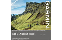
Topographical maps or TOPO maps (for short) range are the premium map series from Garmin for exploring and navigating the great outdoors and countryside of Great Britain, France, Spain, Germany, Italy and Switzerland to name a few of the available Garmin TOPO map titles. As well as hiking/walking, the Garmin topographic map series are also perfect for mountain biking, skiing, etc and provide high-detailed scale maps of around 1:50K to 1:25K scale.
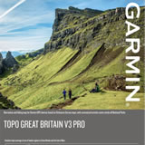 The latest Garmin TOPO map series uses the best in available maps for each country. For example, Great Britain TOPO maps use Ordnance Survey (OS) data at a scale of either 1:50K or 1:25K, while the French TOPO map titles use IGN data at a scale of 1:25K.
For walking/hiking in Great Britain, Garmin Dakota 20 owners have two options:
1. Garmin TOPO Great Britain V3 PRO 1:25K SD/microSD card (pictured right)
2. Garmin TOPO Great Britain V3 PRO 1:50K SD/microSD card
All Garmin TOPO maps come supplied on plug-and-play SD/microSD card.
View the full range of compatible Garmin Dakota 20 TOPO maps.
Garmin Great Britain (GB) Discoverer map series has been discontinued by Garmin and replaced by the Garmin TOPO series (see above section of maps). The Garmin GB Discoverer map series comprised of more than 60 GB Discoverer map titles. Each map title covered a specific National Park or National Trail in Great Britain e.g. Yorkshire Wolds Way at a scale of 1:25K.
 In comparison the new Garmin TOPO GB map at a scale of 1:25K now features the whole of Great Britain, negating the need to buy multiple map SD/microSD cards. However, if you only planned to visit one single National Park or National Trail you could save a lot of money, by just buying the area you require e.g. 1:25K Rannoch and Loch Tay, rather than buying the map for the whole country.
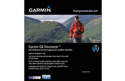
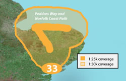
While the majority of Garmin GB Discoverer titles are now sold out, we do have limited number of maps available to buy from ActiveGPS. Currently available 1:25K scale GB Discoverer maps that you can buy from ActiveGPS.co.uk include: 1:25K Glyndwr's Way, 1:25K Northumberland,1:25K Central Highlands and 1:25K Peddars Way and Norfolk Coast Path (pictured right).
All Garmin GB Discoverer maps come supplied on plug-and-play SD/microSD card. View the full range of compatible Garmin Dakota 20 GB Discoverer maps
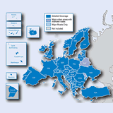 If you are seeking street-level road maps for your Garmin Dakota 20 for driving, road cycling, etc, then look no further than the Garmin City Navigator NT map series. Garmin City Navigator maps feature street-level detail for a specific country or region e.g. Full Europe (UK, Eastern and Western Europe) (pictured right) and North America (USA, Canada and Mexico).
Garmin City Navigator maps come supplied on pre-programmed SD/microSD card and are not locked to single use within the Garmin Dakota 20. So if you also have a Garmin car sat nav and wish to use the road maps in your compatible Garmin sat nav device you can do so, just not at the same time.
Also available is the Garmin Dakota 20 Vehicle Mount Kit. The Dakota 20 vehicle mount kit includes windscreen mount and vehicle power cable and is perfect for in-car use.
View and buy the available compatible Garmin Dakota 20 City Navigator NT maps.
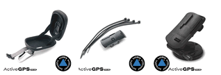
As well as selling a comprehensive range of authentic Garmin mapping titles for use with the Garmin Dakota 20, we also sell a comprehensive range of genuine Garmin Dakota 20 accessories.
 Why Buy from ActiveGPS?
We are official authorised Garmin Internet Retailers, offering genuine Garmin products, accessories, and maps. All our stock is purchased directly from assigned Garmin UK distributors - we do not source from the grey market and never sell counterfeit products.
When you buy from ActiveGPS.co.uk, you can be confident that you’ll receive full Garmin support and the peace of mind that comes with purchasing authentic, reliable products.
Page updated: 2nd January 2026
ActiveGPS.co.uk
Customer Service
Telephone Number:
01733 777623
Monday to Friday 9:30am to 5:00pm (UK Time)
Follow us on
![]()
![]()
![]()
![]()
![]()

ActiveGPS.co.uk Copyright © Active Alliance Limited 2005-2026 | Company Number - 05200677 | VAT Number - GB 834 2222 57
Text compiled by and copyright Active Alliance Ltd. Plagiarism software in use - do not copy any of our website text, images or videos.