FREE UK delivery when you spend £50 - see more delivery options.

Homepage / GPS / Handheld GPS / Garmin GPSMAP 66i
Product Codes: GAR66I, GAR66I50
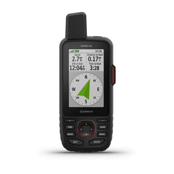
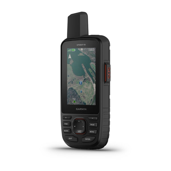
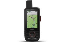
The Garmin GPSMAP 66i is a handheld GPS device which is ideal for walking, hiking, biking and more. The GPSMAP 66i has a 3-inch colour screen and is compatible with other devices with connectivity using WiFi, BLUETOOTH and ANT+. It comes preloaded with full European TopoActive mapping.
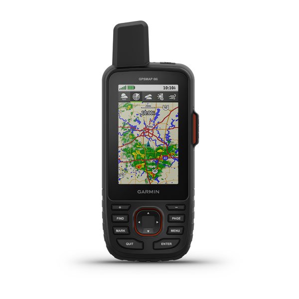
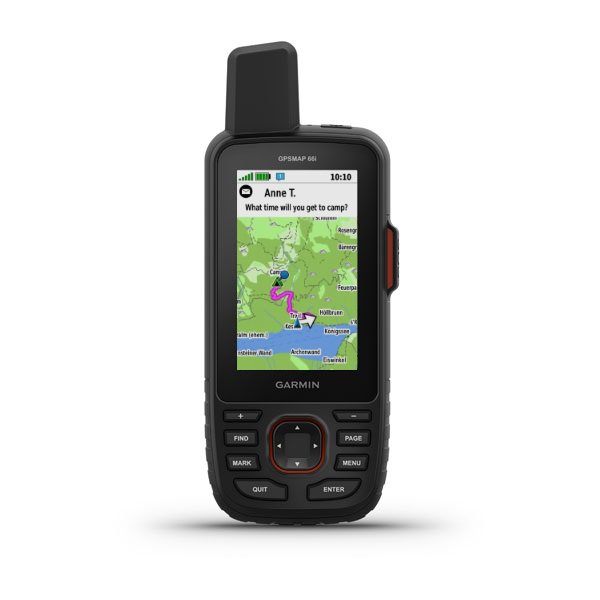
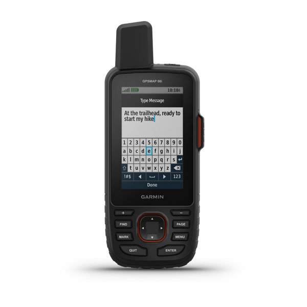
Two-way messaging via the 100% global iridium satellite network (satellite subscription required) is also available. Furthermore cellular connectivity (when connected to Garmin Connect Mobile) lets you view Active Weather forecasts maps (temperature, wind, precipitation and clouds) and Geocaching Live. Also us LiveTrack location sharing via connection to the 100% global Iridium satellite network.
You can also add additional mapping to this GPSMAP 66i for recreational use, driving, use on water and more. It is also perfect for paperless geocaching as it will record location, terrain, difficulty, hints and descriptions.
Purchase the Garmin GPSMAP 66i with TOPO Great Britain V3 PRO 1:50K on pre-programmed microSD/SD card. See second option basket below
![]()
Garmin GPSMAP 66i has been discontinued.
Accessories for the Garmin GPSMAP 66i can be purchased from ActiveGPS.
View latest handhelds.
The replacement and equalivent model to the Garmin GPSMAP 66s is the Garmin GPSMAP 67i.
 Deliveries
We offer UK, Europe and Worldwide deliveries. We despatch orders at 4:30pm on Monday, Tuesday, Wednesday, Thursday and Friday. We need to receive your order on those days by 3:00pm. When possible we may despatch orders received after that time. No orders are despatched on Saturday, Sunday or Bank Holidays in England and Wales.
We offer FREE UK delivery on all orders of £50.00 or more, plus next working day and guaranteed Saturday delivery options. Click here for further info. All options also appear at the basket pages.
 The Garmin GPSMAP 66i is a rugged GPS handheld and inReach satellite communicator which includes Garmin TopoActive Europe mapping and has a 3-inch screen. Using the satellite connection you can use two-way messaging via the 100% global iridium satellite network (satellite subscription required). Furthermore cellular connectivity (when connected to Garmin Connect Mobile) lets you view Active Weather forecasts maps (temperature, wind, precipitation and clouds) and Geocaching Live. You can also use LiveTrack location sharing via connection to the 100% global Iridium satellite network.
You will be able to connect the GPSMAP 66i to other compatible devices using WiFi, BLUETOOTH and ANT+. When paired with a mobile phone you will have access to inReach features. For example you will have access to your phone's contact list. You can send and receive text messages to SMS and email or send messages to other inReach users to, for example, exchange locations.
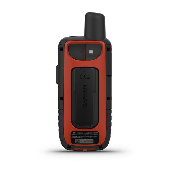
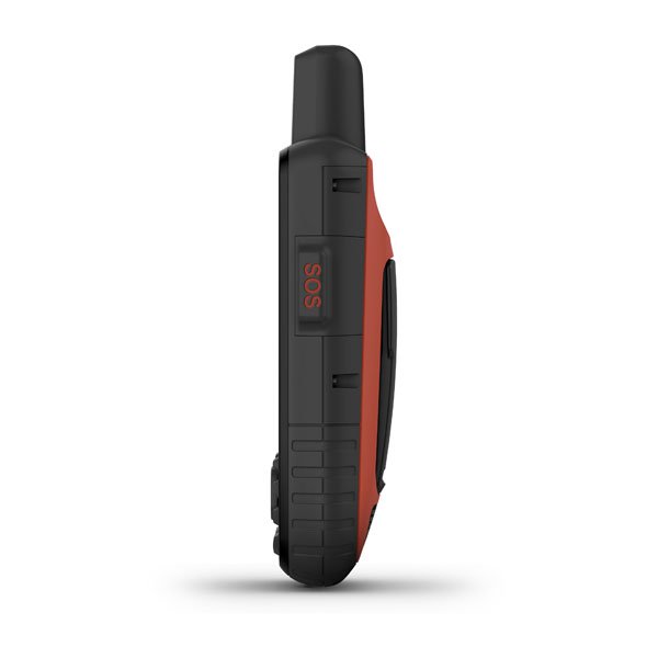
 You can send out SOS distress calls to GEOS 24/7 via satellite connection.
The Garmin GPSMAP 66i is waterproof to IPX7 standards. You can store: microSD's (not included), 10,000 waypoints, 250 routes and 20,000 points, 250 saved tracks, 300 saved fit archives. These features and more make the GPSMAP 66i ideal for geocaching. There is also a hunt/fish calendar, sun and moon information and picture viewer.
Garmin GPS navigation is possible using the preloaded Garmin TopoActive Europe mapping which provides topographic elevations, summits, parks, coastlines, rivers, lakes and geographical points. Birds Eye direct to device is available with Garmin Annual Subscription which is required and sold separately.
There is a 3-inch sunlight-readable colour display on the Garmin GPSMAP 66i and an internal rechargeable lithium battery which provides up to 35 hours of battery life in 10-minute tracking mode and 200 hours in Expedition mode with 30-minute tracking intervals. Please note: The Garmin GPSMAP 66i is not compatible with AA batteries.
Plus you can manage waypoints, routes, activities and collections, use tracks and review trip data. You can manage these details using the Garmin Explore website and Garmin app.
Altimeter, barometer and compass navigation sensors also let you track and navigate in challenging environments.
Additional mapping is available to purchase separately for use with the Garmin GPSMAP 66i. Learn more about the different compatible Garmin map series that you can use with the Garmin GPSMAP 66i. Popular Garmin map titles for customers in the UK include Garmin TOPO Great Britain V3 PRO 1:50K microSD/SD card (Ordnance Survey Landranger maps) and Garmin TOPO Great Britain V3 PRO 1:25K microSD/SD card (Ordnance Survey Landranger and Explorer maps). View all of the different Garmin TOPO 1:10K, 1:25K, 1:50K map titles that you can buy from ActiveGPS.
Do you have a question about the Garmin GPSMAP 66i or other handheld GPS related question that's not been answered on this webpage? Please see our handheld and Outdoor GPS FAQs page for questions from other customers.Plus if the answer to your question isn't featured, use the online form to ask us for the answer. Alternatively please telephone 01733 777623 Monday to Friday (9:30am-5:00pm) to speak to one of our sales team. For further information online please see the Garmin GPSMAP comparison table.
‣Slim, lightweight
‣Bright 3-inch sunlight readable colour display
‣Preloaded TopoActive Europe maps
‣BirdsEye satellite imagery downloads available
‣inReach communction; two-way messaging via the 100% global Iridium satellite network
‣Altimeter, electronic compass and barometric altimeter
‣Rugged, waterproof (IEC 60529 IPX7)
‣16GB internal memory
‣Supports paperless geocaching; store waypoints, routes, tracks, hints and descriptions
‣TrackBack feature
‣Up to 35 hours battery life at 10-minute tracking; up to 200 hours battery life at 30-minute tracking (power save mode)
‣USB and NMEA 0183 compatible
‣2 year guarantee
Garmin GPSMAP 66i is preloaded with a worldwide TopoActive including Full Europe.
Please note: Additional maps can be loaded to the GPSMAP 66i. The GPSMAP 66i features a SD/microSD Card slot, an easy way to add new maps and mapping updates. Read more about the additional maps you can buy from ActiveGPS.co.uk for the Garmin GPSMAP 66i.
Product Code: GAR66I
‣Garmin GPSMAP 66i
‣Preloaded TopoActive Europe maps
‣Access to Birdseye satellite imagery without an annual subscription
‣Charging/data cable
‣Carabiner clip
‣Documentation
Product Code: GAR66I50
‣Garmin GPSMAP 66i
‣Preloaded TopoActive Europe maps
‣Garmin TOPO Great Britain V3 PRO 1:50K on pre-programmed microSD/SD card
‣Access to Birdseye satellite imagery without an annual subscription
‣Charging/data cable
‣Carabiner clip
‣Documentation
Looking for accessories and spares for the Garmin GPSMAP 66i? Accessories available to purchase include a carrying case, retractable lanyard and vehicle mount kit. Along with these accessories, it is also possible to buy replacement parts such as belt clip and mains charger. View all Garmin GPSMAP 66i accessories.
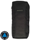
Garmin GPSMAP 66i Soft Carrying Case
£17.99
‣Safely store your Garmin GPSMAP 66i when you're not using it with this Garmin branded soft carrying case.
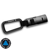
Garmin GPSMAP 66i Carabiner Clip
£12.99
‣Attach your Garmin GPSMAP 66s on any secure hook, loop or carabiner clip.

Garmin GPSMAP 66 Flotation Lanyard
£9.99
‣Keep your Garmin GPSMAP 66 secure and close at hand while you are on the water with this neoprene flotation lanyard.
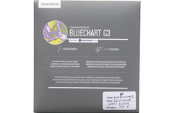
The Garmin GPSMAP 66i is preloaded with Europe TOPO Active maps. These maps are a scale of between 1:100K and 1:250K. If you would like a better scale e.g, 1:50K or even 1:25K scale, then look no further than the Garmin TOPO map series. In addition the Garmin GPSMAP 66i is also compatible with both the Garmin City Navigator (street-level road map) series perfect for driving and/or road cycling and for use on the water around the UK, Europe you need the marine Garmin BlueChart g3 series. Learn more about the different Garmin GPSMAP 66i maps.
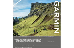
Garmin GPSMAP 66i Topographical Maps
‣Explore 1:25K or 1:50K the UK and Europe with Topographical mapping
‣Read more about Topographical maps

Garmin GPSMAP 66i City Navigator Maps
‣City Navigator Street-Level maps is available for world countries and regions
‣Read more about Garmin City Navigator maps
‣Technology: GPS, Global Iridium Satellite Network, WiFi, Bluetooth, ANT+
‣Satellite networks: GPS, GLONASS, GALILEO
‣Display: transflective, colour TFT (240 x 400 pixels)
‣Touchscreen: No
‣Battery: Rechargeable lithium-ion
‣Waypoints/favourites/locations: 10,000
‣Routes: 250
‣Track Log: 20,000 points, 250 saved tracks
‣Basemap: Worldwide
‣Built-in memory: 16GB
‣Accepts SD cards: Yes
‣Waterproof: Yes, IPX7
‣Dimensions: Width - 66mm, Height - 163mm, Depth - 35mm
‣Weight: 241 grams
‣Guarantee: 2-year
‣Garmin GPSMAP 66i manual
![]() Manual requires Adobe Acrobat Reader
Manual requires Adobe Acrobat Reader
Download a free copy here
This product is a sophisticated electronic device which requires that you read, understand, and act upon the information given in the instruction manual (usually available via the above 'manual' link). You will need internet access and, in accordance with the manufacturers’ recommendations, regularly seek out and accept all firmware or software updates offered by the manufacturer. All GPS devices need to ‘see’ the satellites in the sky. Therefore you will need to know that your vehicle does not have glass that will block or impede the GPS signal.
Updates to this product are via the internet. At this product page we state compatibility with specific versions of current internet connection devices, for example: PC, laptop, MAC, smartphone etc. The Consumer Contract Regulations allow you 14 days, from receipt of purchase, to check compatibility with your internet connection device/s. If you choose to replace or update your PC, MAC etc. neither we nor the manufacturer will be responsible if the new/replacement Operating System (OS) is not compatible with the purchased product.
Do you have a question about the Garmin GPSMAP 66i? Submit your question via our contact page.
Why Buy from ActiveGPS?We are official authorised Garmin Internet Retailers, offering genuine Garmin products, accessories, and maps. All our stock is purchased directly from assigned Garmin UK distributors - we do not source from the grey market and never sell counterfeit products.
When you buy from ActiveGPS.co.uk, you can be confident that you’ll receive full Garmin support and the peace of mind that comes with purchasing authentic, reliable products.
Page last reviewed: 2nd January 2026
ActiveGPS.co.uk
Customer Service
Telephone Number:
01733 777623
Monday to Friday 9:30am to 5:00pm (UK Time)
Follow us on
![]()
![]()
![]()
![]()
![]()

ActiveGPS.co.uk Copyright © Active Alliance Limited 2005-2026 | Company Number - 05200677 | VAT Number - GB 834 2222 57
Text compiled by and copyright Active Alliance Ltd. Plagiarism software in use - do not copy any of our website text, images or videos.